Derby sits on a mix of alluvial sands and gravels over Mercia Mudstone, with shallow groundwater in the Derwent valley. These conditions make buried utility strikes and void collapse a real risk during excavation. A GPR (Ground Penetrating Radar) survey in Derby picks up these anomalies before you break ground. We use 250 MHz to 1.6 GHz antenna arrays depending on target depth and soil conductivity. For shallow services in clay-rich zones, combining GPR with a drenaje-geotecnico study helps manage water flow around foundations. The method is non-invasive, fast, and works on tarmac, concrete, and soft ground.
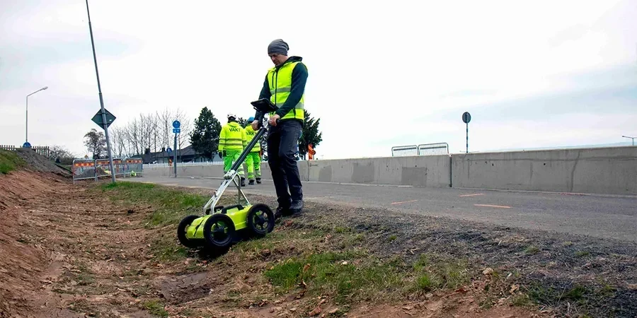
In Derby’s mixed alluvial and mudstone ground, GPR locates utilities and voids without a single excavation, reducing risk of costly strikes.
Process overview
Local context
Derby expanded rapidly during the Industrial Revolution, with old canals, mill foundations, and buried railway infrastructure crisscrossing the city centre. Many of these structures are unmapped or recorded on outdated plans. Hitting a forgotten culvert or a live gas main during excavation can halt a project for days and cost thousands in repairs. A GPR survey in Derby before any digging identifies these unknowns. It also detects solution features in the gypsum-bearing Mercia Mudstone, which can open into voids under load. The risk is real, especially in the Cathedral Quarter and Pride Park areas where historic fill is common.
Reference standards
BS 8578:2015 – Code of practice for utility detection and verification, BS 5930:2015 – Code of practice for ground investigations, Eurocode 7 (EN 1997-1:2004) – Geotechnical design, HSG47 – Avoiding danger from underground services
Additional services
Utility Mapping
Locate buried pipes, cables, and ducts before excavation. We mark positions on the surface and provide CAD plans showing depth and alignment. Typical searches cover gas, water, telecoms, and HV cables.
Concrete Scanning
Detect rebar, tendons, and voids in slabs and walls. Used for core drilling safety and post-tensioned slab assessment. Our 1.6 GHz antenna resolves reinforcement down to 6 mm diameter.
Void and Cavity Detection
Identify subsurface voids, sinkholes, and poorly compacted backfill. Essential for sites underlain by gypsum dissolution features or historic mine workings. We produce depth-slice maps showing anomaly extent.
Typical parameters
Common questions
How deep can GPR see in typical Derby soils?
In the free-draining sands and gravels of the Derwent valley, GPR reaches up to 4 m depth. In the clay-rich Mercia Mudstone areas like Spondon and Mickleover, penetration drops to around 1.5–2 m due to higher electrical conductivity.
What is the typical cost of a GPR survey in Derby?
For a standard utility search on a 0.1 ha site, the cost ranges between £6,720 and £11,300. Larger areas and complex 3D grids increase the price. Contact us for a site-specific quote.
Do you need access to both sides of a wall for concrete scanning?
No. GPR works from a single side. We scan the surface and the radar wave reflects off rebar, tendons, or voids behind it. That makes it ideal for bridge decks, tunnel linings, and post-tensioned slabs where access is limited.
Can GPR distinguish between a pipe and a void?
Yes, in most cases. A pipe produces a hyperbolic reflection with a distinct apex, while a void creates a stronger, broader anomaly with possible ringing behind it. We use 3D grid analysis and ground truthing to confirm ambiguous targets.